Samaria and Nearby Territories Map

Samaria and Nearby Territories Map image

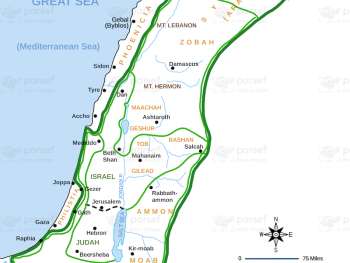
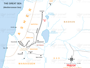
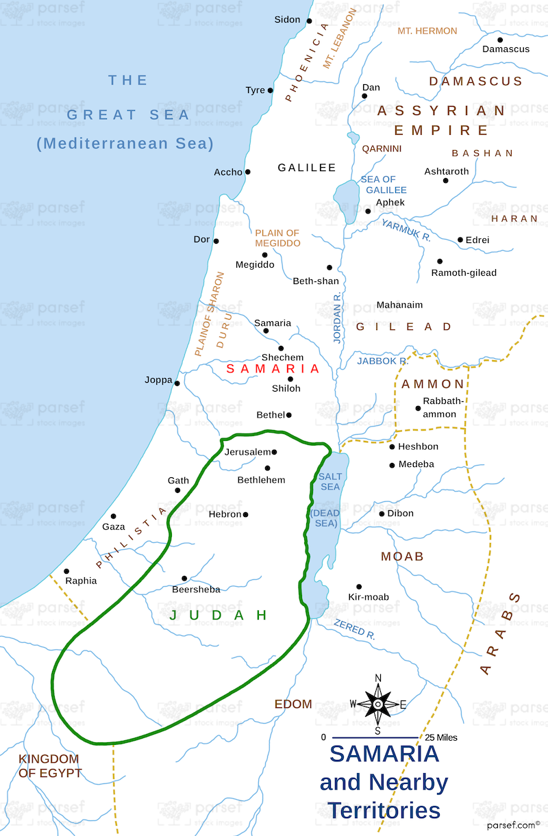
Samaria and Nearby Territories Map: This map shows the region of Samaria, a significant area in the northern kingdom of Israel during the time of the Old Testament. It includes surrounding territories like Galilee and Judah. The map provides context for the biblical narratives involving the division of Israel and the conflict between the kingdoms of Israel and Judah.


Download High Resolution 300 DPI File Samaria and Nearby Territories Map


Related Maps

Genesis Nile River Map image
Read More

Genesis Nile River Map

Genesis Nile River Map: This map focuses on the Nile River and its importance in the biblical narrative. It highlights...
Read More

Egypt in Bible Times Map image
Read More

Egypt in Bible Times Map

Egypt in Bible Times Map: This map outlines Egypt’s geography and its significance during biblical times. It includes major cities,...
Read More

The Red Sea Map image
Read More

The Red Sea Map

The Red Sea Map: This map highlights the Red Sea, a significant body of water in the Bible, particularly in...
Read More

Israel and Judah Color Map image
Read More

Israel and Judah Color Map

Israel and Judah Color Map: This map illustrates the territories of Israel and Judah, including their capitals, Jerusalem and Samaria....
Read More

Benjamin’s Territory Map image
Read More

Benjamin’s Territory Map

Benjamin’s Territory Map: This map outlines the tribal territory of Benjamin in ancient Israel. It highlights key cities such as...
Read More