Paul’s Final Visits Map

Paul’s Final Visits Map image

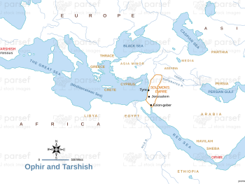
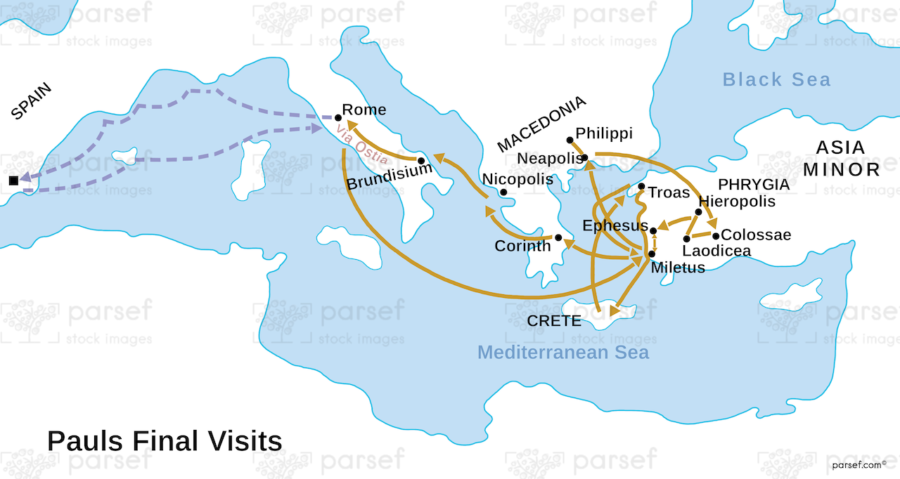
Paul’s Final Visits Map: This map traces the final travels of Paul, including his journey to Jerusalem, his arrest, and his subsequent voyage to Rome. It shows the locations where Paul visited in his last years, including Caesarea and the shipwreck on Malta. The map provides context for Paul’s final testimony and imprisonment.


Download High Resolution 300 DPI File Paul’s Final Visits Map


Related Maps

The Khabur River Map image
Read More

The Khabur River Map

The Khabur River Map: This map highlights the region surrounding the Khabur River, an important river in ancient Mesopotamia. It...
Read More

Israel and Syria Map image
Read More

Israel and Syria Map

Israel and Syria Map: This map highlights the relations between Israel and Syria, especially during periods of conflict and alliances....
Read More

Jabesh Gilead Map image
Read More

Jabesh Gilead Map

Jabesh Gilead Map: This map highlights the location of Jabesh Gilead, a city mentioned in the Bible during the time...
Read More

Exodus Red Sea Map image
Read More

Exodus Red Sea Map

Exodus Red Sea Map: This map depicts the crossing of the Red Sea during the Israelites' exodus from Egypt. It...
Read More

Roman World Maccabees Map image
Read More

Roman World Maccabees Map

Roman World Maccabees Map: This map focuses on the Roman Empire’s interaction with the Maccabean Kingdom during the 2nd century...
Read More