Paul’s Voyage to Rome Map

Paul’s Voyage to Rome Map image

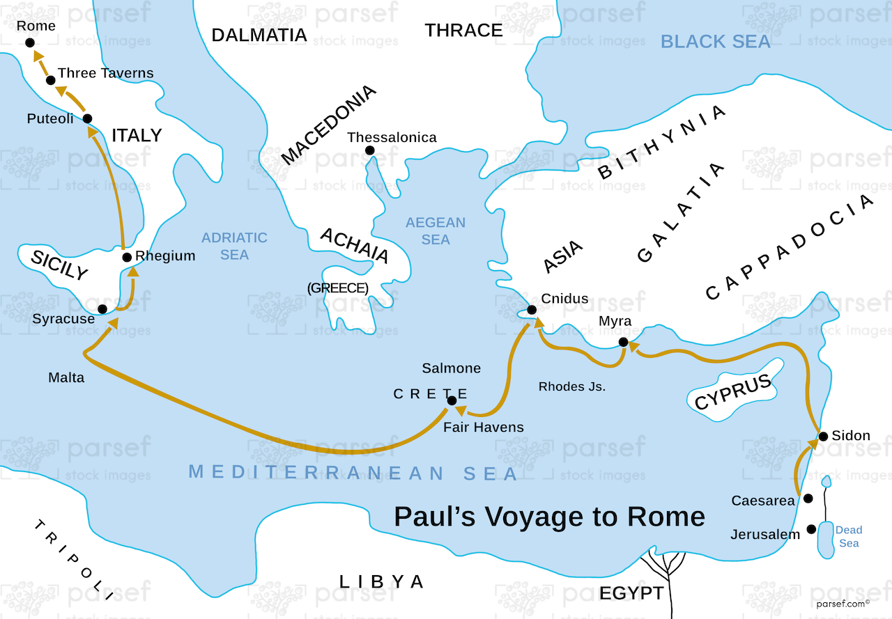
Paul’s Voyage to Rome Map: This map illustrates Paul’s journey to Rome, including his shipwreck on Malta. It highlights the key locations along the Mediterranean Sea, such as Crete and Sicily. The map provides a visual reference for the trials Paul faced as he made his way to the Roman capital for trial.


Download High Resolution 300 DPI File Paul’s Voyage to Rome Map


Related Maps

Jabesh Gilead Map image
Read More

Jabesh Gilead Map

Jabesh Gilead Map: This map highlights the location of Jabesh Gilead, a city mentioned in the Bible during the time...
Read More

Egypt in Bible Times Map image
Read More

Egypt in Bible Times Map

Egypt in Bible Times Map: This map outlines Egypt’s geography and its significance during biblical times. It includes major cities,...
Read More

Idumea Map image
Read More

Idumea Map

Idumea Map: This map shows the region of Idumea, located south of Judea and associated with the descendants of Esau....
Read More

Samaria Map image
Read More

Samaria Map

Samaria Map: This map focuses on the region of Samaria, the capital of the northern kingdom of Israel. It shows...
Read More

Asia in Roman Times Map image
Read More

Asia in Roman Times Map

Asia in Roman Times Map: This map highlights the province of Asia during Roman rule. It includes major cities, trade...
Read More

The Red Sea Map image
Read More

The Red Sea Map

The Red Sea Map: This map highlights the Red Sea, a significant body of water in the Bible, particularly in...
Read More

Kingdom of Jeroboam Map image
Read More

Kingdom of Jeroboam Map

Kingdom of Jeroboam Map: This map illustrates the kingdom of Israel under Jeroboam I after the division of the united...
Read More