Israel in 1949 With Boundaries Map

Israel in 1949 With Boundaries Map image

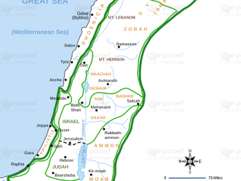
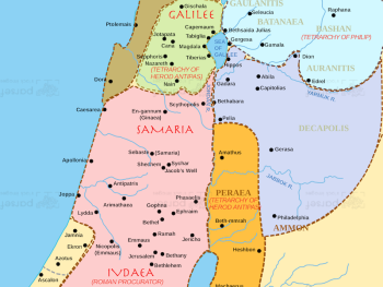
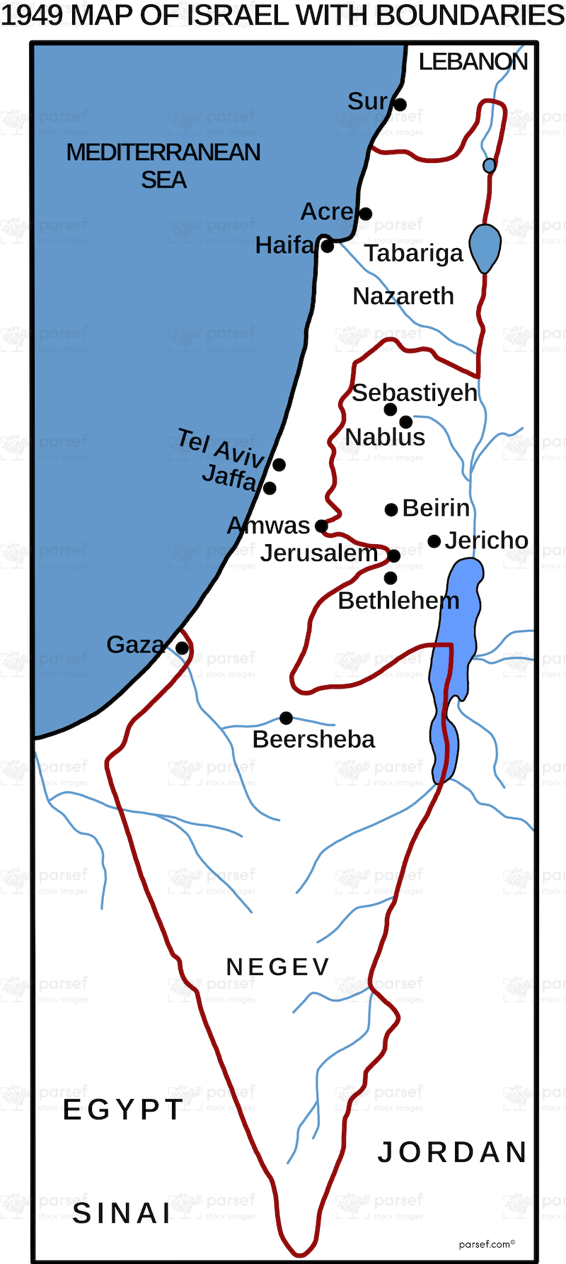
Israel in 1949 With Boundaries Map: This map shows the state of Israel in 1949, shortly after its establishment, with borders defined by the armistice agreements. It highlights the territorial divisions with neighboring countries. The map provides historical context for the early years of the Israeli state.


Download High Resolution 300 DPI File Israel in 1949 With Boundaries Map


Related Maps

Assyrian Empire Map image
Read More

Assyrian Empire Map

Assyrian Empire Map: Explore the vast expanse of the Assyrian Empire at its height. This map includes major cities, trade...
Read More

Kirjath Jearim Map image
Read More

Kirjath Jearim Map

Kirjath Jearim Map: This map focuses on the city of Kirjath Jearim, an important location in the Bible, particularly in...
Read More

The Red Sea Map image
Read More

The Red Sea Map

The Red Sea Map: This map highlights the Red Sea, a significant body of water in the Bible, particularly in...
Read More

Babylonian Empire New image
Read More

Babylonian Empire New

Babylonian Empire New Map: This map depicts the New Babylonian (Chaldean) Empire, including its territories and capital, Babylon. It highlights...
Read More

Canaanite Nations Map image
Read More

Canaanite Nations Map

Canaanite Nations Map: This map highlights the locations and territories of the Canaanite nations mentioned in the Bible. It shows...
Read More