Persian Empire at Time of Esther Map

Persian Empire at Time of Esther Map image

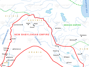
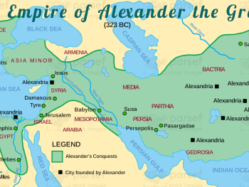
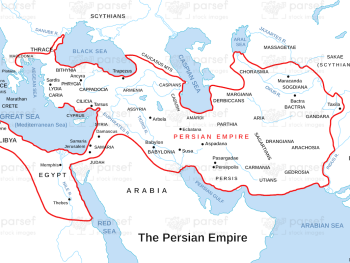
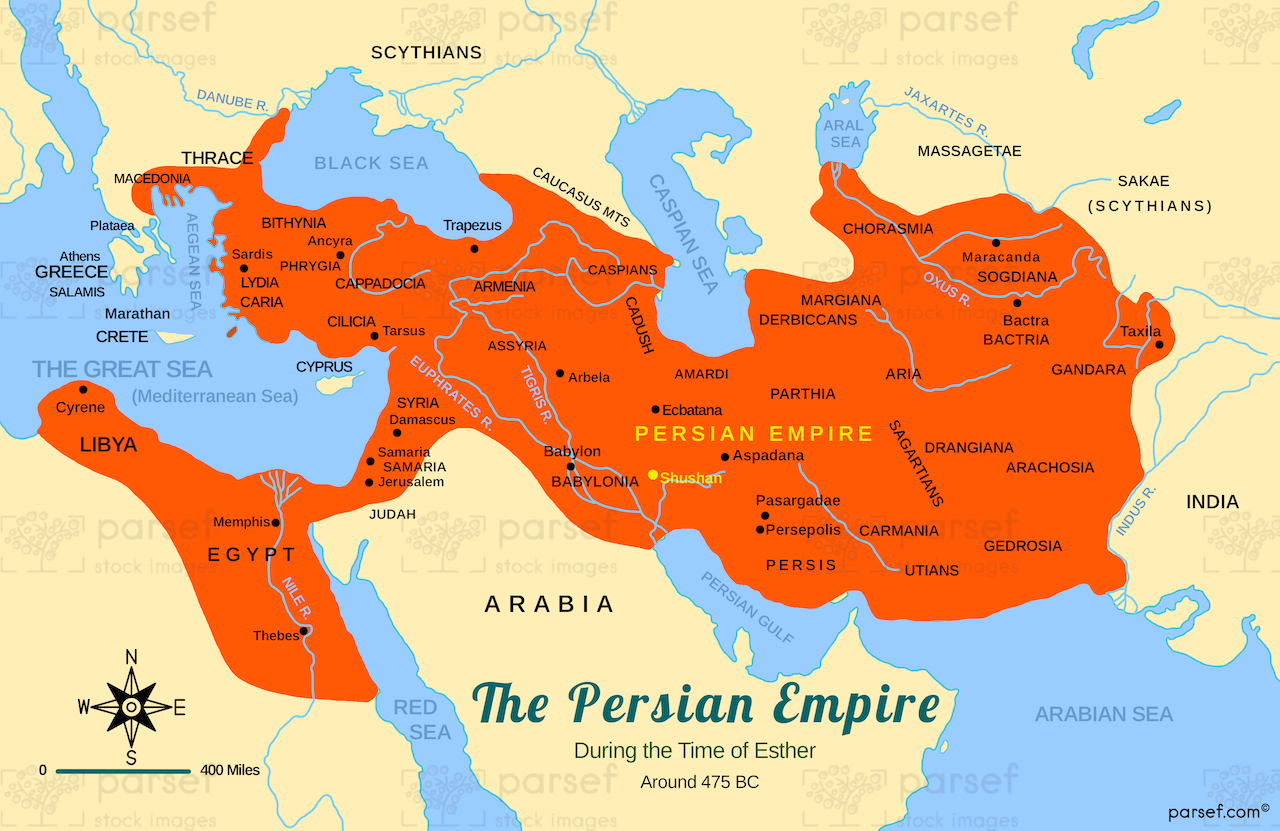
Persian Empire at Time of Esther Map: This map illustrates the Persian Empire during the time of Queen Esther. It highlights key locations like Susa, Persia’s capital, and the vast territories under Persian rule. The map offers context for the events of the Book of Esther, including the Jews’ deliverance from Haman’s plot.


Download High Resolution 300 DPI File Persian Empire at Time of Esther Map


Related Maps

Asia in Roman Times Map image
Read More

Asia in Roman Times Map

Asia in Roman Times Map: This map highlights the province of Asia during Roman rule. It includes major cities, trade...
Read More

Roman World Maccabees Map image
Read More

Roman World Maccabees Map

Roman World Maccabees Map: This map focuses on the Roman Empire’s interaction with the Maccabean Kingdom during the 2nd century...
Read More

Israel and Judah Color Map image
Read More

Israel and Judah Color Map

Israel and Judah Color Map: This map illustrates the territories of Israel and Judah, including their capitals, Jerusalem and Samaria....
Read More

Idumea Map image
Read More

Idumea Map

Idumea Map: This map shows the region of Idumea, located south of Judea and associated with the descendants of Esau....
Read More