Kingdom of Jeroboam Map

Kingdom of Jeroboam Map image

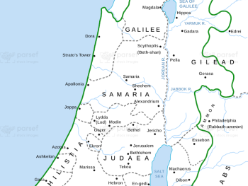
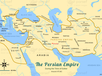
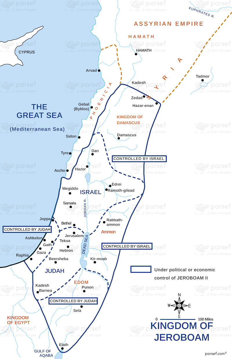
Kingdom of Jeroboam Map: This map illustrates the kingdom of Israel under Jeroboam I after the division of the united monarchy. It shows the capital of Samaria and the regions of Israel. The map provides context for the rise of Jeroboam’s reign and the religious and political challenges of his kingdom.


Download High Resolution 300 DPI File Kingdom of Jeroboam Map


Related Maps

Israel and Syria Map image
Read More

Israel and Syria Map

Israel and Syria Map: This map highlights the relations between Israel and Syria, especially during periods of conflict and alliances....
Read More

Genesis Shem Ham Japheth Map image
Read More

Genesis Shem Ham Japheth Map

Genesis Shem Ham Japheth Map: This map shows the descendants of Noah’s sons—Shem, Ham, and Japheth—and their settlements. It highlights...
Read More

Zorah Map image
Read More

Zorah Map

Zorah Map: This map shows the location of Zorah, a city in the territory of Dan, which plays a role...
Read More

Exodus Mount Horeb Map image
Read More

Exodus Mount Horeb Map

Exodus Mount Horeb Map: This map focuses on Mount Horeb (Sinai), where Moses received the Ten Commandments. It highlights the...
Read More

Samaria Map image
Read More

Samaria Map

Samaria Map: This map focuses on the region of Samaria, the capital of the northern kingdom of Israel. It shows...
Read More

Ophir and Tarshish Map image
Read More

Ophir and Tarshish Map

Ophir and Tarshish Map: This map shows the locations of Ophir and Tarshish, two regions mentioned in the Bible as...
Read More