Asia in Roman Times Map

Asia in Roman Times Map image

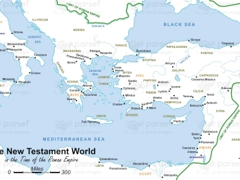
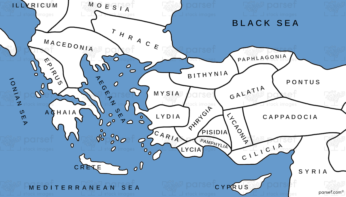
Asia in Roman Times Map: This map highlights the province of Asia during Roman rule. It includes major cities, trade routes, and cultural centers. It provides insight into the region’s significance in the New Testament and the Roman Empire.


Download High Resolution 300 DPI File Asia in Roman Times Map


Related Maps

Jabesh Gilead Map image
Read More

Jabesh Gilead Map

Jabesh Gilead Map: This map highlights the location of Jabesh Gilead, a city mentioned in the Bible during the time...
Read More

Exodus Red Sea Map image
Read More

Exodus Red Sea Map

Exodus Red Sea Map: This map depicts the crossing of the Red Sea during the Israelites' exodus from Egypt. It...
Read More

Amalekites Territory Map image
Read More

Amalekites Territory Map

Amalekites Territory Map: This map outlines the territory of the Amalekites, an ancient nomadic tribe mentioned in the Bible. It...
Read More

Exodus from Egypt Map image
Read More

Exodus from Egypt Map

Exodus from Egypt Map: This map traces the route of the Israelites during their exodus from Egypt. It highlights key...
Read More

Genesis Nile River Map image
Read More

Genesis Nile River Map

Genesis Nile River Map: This map focuses on the Nile River and its importance in the biblical narrative. It highlights...
Read More

I Samuel Shiloh Map image
Read More

I Samuel Shiloh Map

I Samuel Shiloh Map: This map focuses on Shiloh, a central location in the Book of 1 Samuel. It highlights...
Read More

Ancient Nubia Map image
Read More

Ancient Nubia Map

Ancient Nubia Map: This map showcases the region of ancient Nubia, located south of Egypt. It highlights the Kingdom of...
Read More