Paul’s 2nd Missionary Journey Map

Paul’s 2nd Missionary Journey Map image

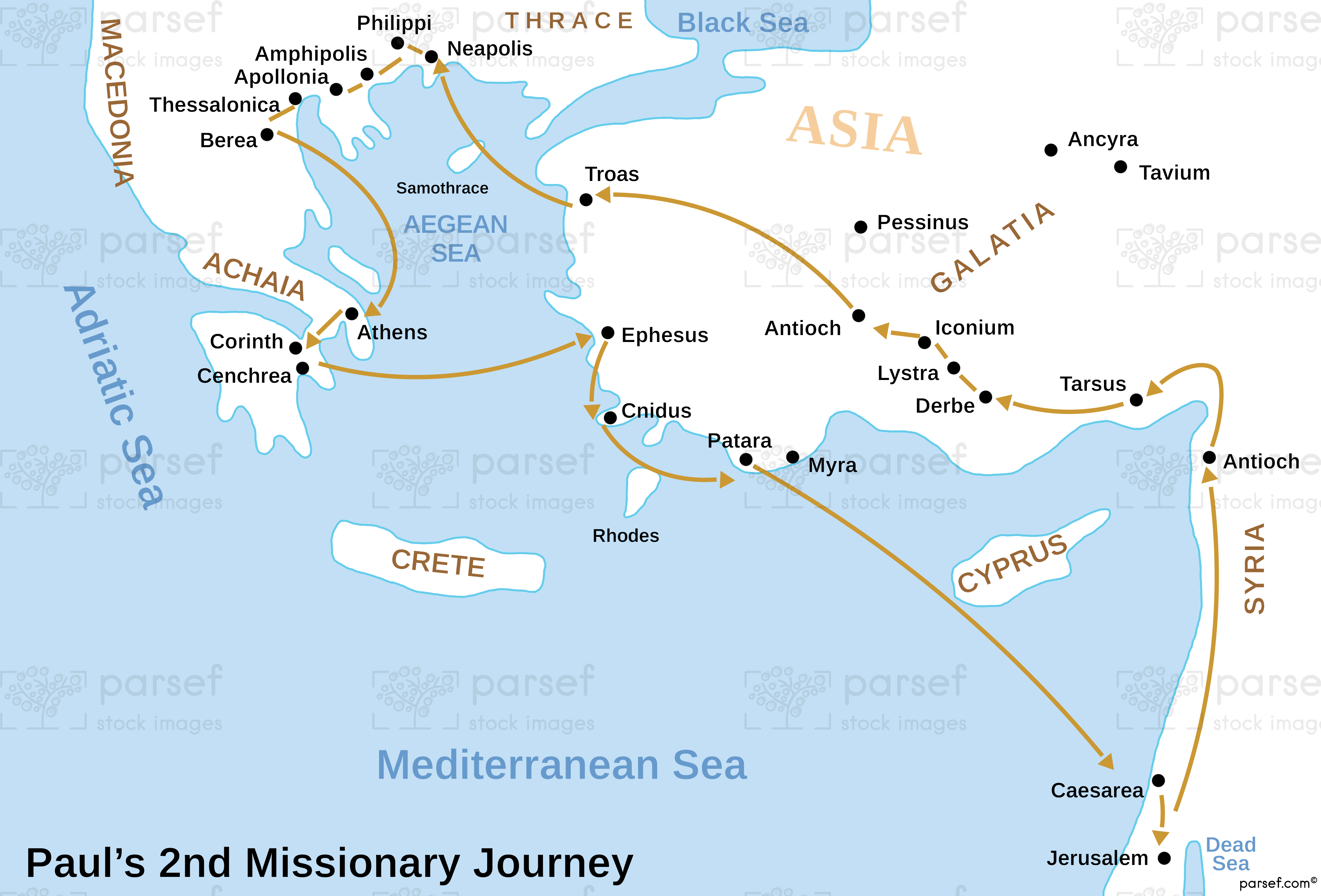
Paul’s 2nd Missionary Journey Map: This map shows the route of Paul’s second missionary journey, which took him through regions like Macedonia, Philippi, and Thessalonica. It highlights the expansion of Christian communities in Greece and Asia Minor. The map provides insight into Paul’s strategy for spreading the Gospel in Europe.


Download High Resolution 300 DPI File Paul’s 2nd Missionary Journey Map


Related Maps

The Khabur River Map image
Read More

The Khabur River Map

The Khabur River Map: This map highlights the region surrounding the Khabur River, an important river in ancient Mesopotamia. It...
Read More

Idumea Map image
Read More

Idumea Map

Idumea Map: This map shows the region of Idumea, located south of Judea and associated with the descendants of Esau....
Read More

Genesis the Hamites Map image
Read More

Genesis the Hamites Map

Genesis the Hamites Map: This map shows the regions settled by the descendants of Ham, including Canaan, Egypt, and Cush....
Read More

Hebron Map image
Read More

Hebron Map

Hebron Map: This map focuses on the city of Hebron, a significant location in both the Old and New Testaments....
Read More

The Red Sea Map image
Read More

The Red Sea Map

The Red Sea Map: This map highlights the Red Sea, a significant body of water in the Bible, particularly in...
Read More

Ancient Samaria Map image
Read More

Ancient Samaria Map

Ancient Samaria Map: Explore the territory of ancient Samaria, including key cities and landmarks. This map highlights Samaria’s role in...
Read More