Jabesh Gilead Map

Jabesh Gilead Map image

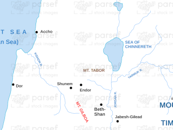
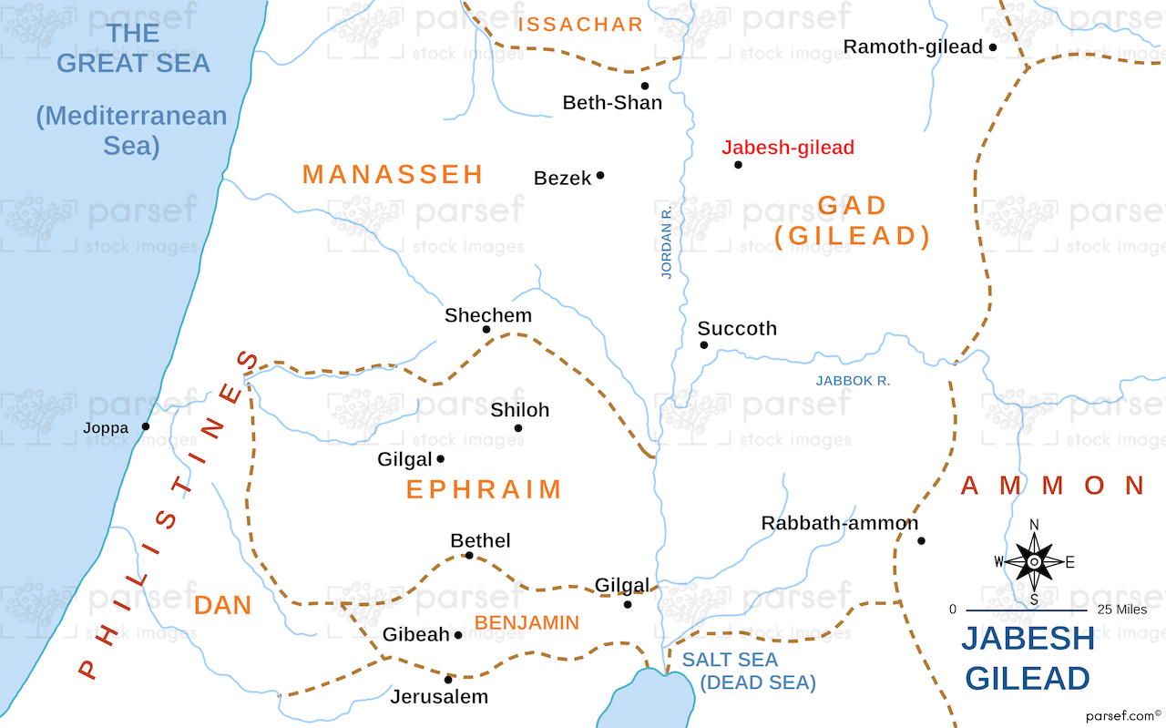
Jabesh Gilead Map: This map highlights the location of Jabesh Gilead, a city mentioned in the Bible during the time of Saul and David. It shows its proximity to the Jordan River and its significance in various biblical events. The map provides insight into the tribe of Gad’s territory and the story of the rescue of the people of Jabesh Gilead.


Download High Resolution 300 DPI File Jabesh Gilead Map


Related Maps

Ancient Samaria Map image
Read More

Ancient Samaria Map

Ancient Samaria Map: Explore the territory of ancient Samaria, including key cities and landmarks. This map highlights Samaria’s role in...
Read More

Roman World Maccabees Map image
Read More

Roman World Maccabees Map

Roman World Maccabees Map: This map focuses on the Roman Empire’s interaction with the Maccabean Kingdom during the 2nd century...
Read More

Exodus Red Sea Map image
Read More

Exodus Red Sea Map

Exodus Red Sea Map: This map depicts the crossing of the Red Sea during the Israelites' exodus from Egypt. It...
Read More

Exodus Route Map image
Read More

Exodus Route Map

Exodus Route Map: This map traces the route of the Israelites from Egypt to the Promised Land. It includes key...
Read More

Exodus Mount Horeb Map image
Read More

Exodus Mount Horeb Map

Exodus Mount Horeb Map: This map focuses on Mount Horeb (Sinai), where Moses received the Ten Commandments. It highlights the...
Read More