Israel Under Rehoboam Map

Israel Under Rehoboam Map image

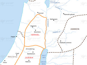
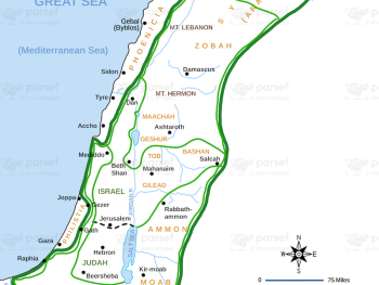
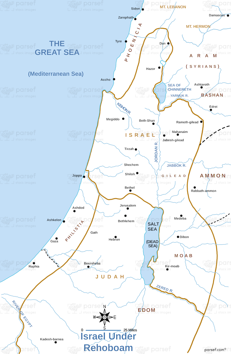
Israel Under Rehoboam Map: This map illustrates the kingdom of Israel under Rehoboam, the son of Solomon, after the kingdom was divided. It highlights the territories of Judah and Israel, including the capital of Jerusalem. The map helps to understand the political situation leading to the split.


Download High Resolution 300 DPI File Israel Under Rehoboam Map


Related Maps

Egypt in Bible Times Map image
Read More

Egypt in Bible Times Map

Egypt in Bible Times Map: This map outlines Egypt’s geography and its significance during biblical times. It includes major cities,...
Read More

Samaria Map image
Read More

Samaria Map

Samaria Map: This map focuses on the region of Samaria, the capital of the northern kingdom of Israel. It shows...
Read More

Idumea Map image
Read More

Idumea Map

Idumea Map: This map shows the region of Idumea, located south of Judea and associated with the descendants of Esau....
Read More

Asia in Roman Times Map image
Read More

Asia in Roman Times Map

Asia in Roman Times Map: This map highlights the province of Asia during Roman rule. It includes major cities, trade...
Read More

Genesis the Hamites Map image
Read More

Genesis the Hamites Map

Genesis the Hamites Map: This map shows the regions settled by the descendants of Ham, including Canaan, Egypt, and Cush....
Read More

Amos Judah Map image
Read More

Amos Judah Map

Amos Judah Map: This map focuses on the regions of Judah mentioned in the Book of Amos. It highlights key...
Read More

Zorah Map image
Read More

Zorah Map

Zorah Map: This map shows the location of Zorah, a city in the territory of Dan, which plays a role...
Read More