Paul’s 1st Missionary Journey Map

Paul’s 1st Missionary Journey Map image

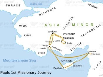
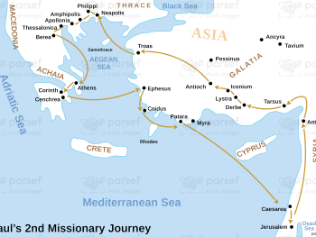
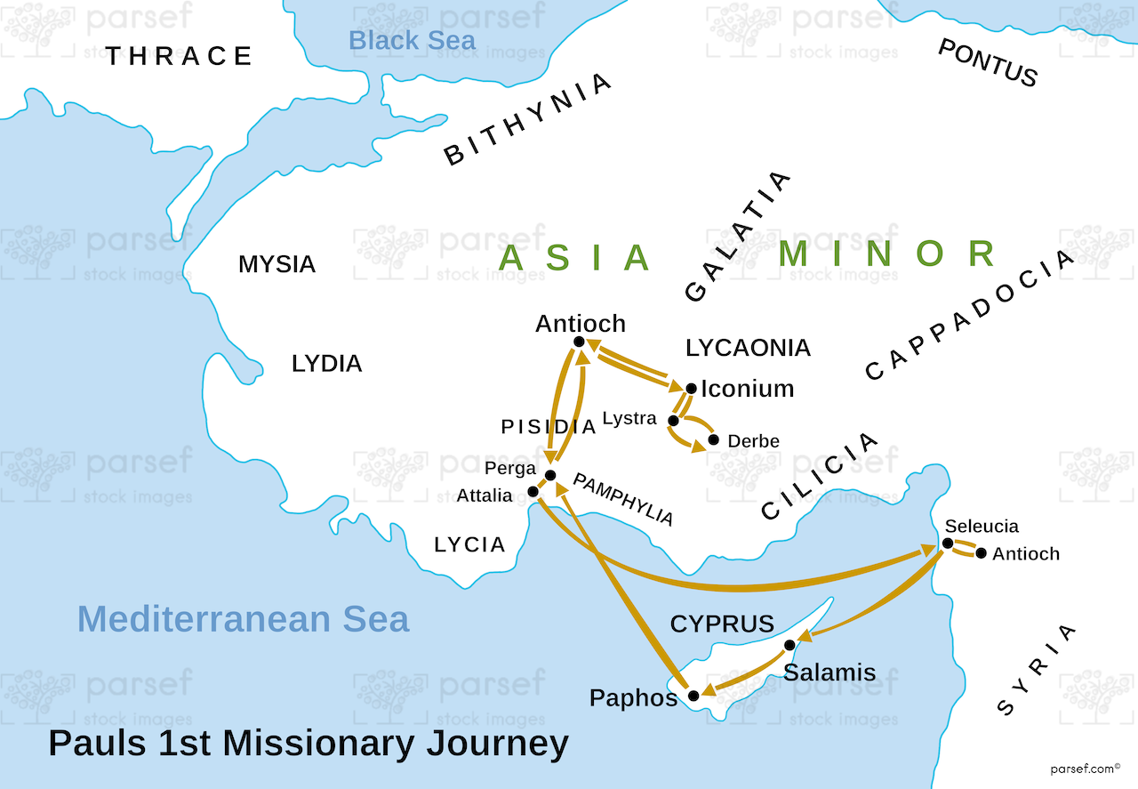
Paul’s 1st Missionary Journey Map: This map traces the path of Paul’s first missionary journey, from Antioch to various regions in Asia Minor, including Cyprus and Pisidian Antioch. It highlights key cities where Paul preached, established churches, and faced opposition. The map provides context for the early expansion of Christianity.


Download High Resolution 300 DPI File Paul’s 1st Missionary Journey Map


Related Maps

Idumea Map image
Read More

Idumea Map

Idumea Map: This map shows the region of Idumea, located south of Judea and associated with the descendants of Esau....
Read More

Kingdom of Saul Map image
Read More

Kingdom of Saul Map

Kingdom of Saul Map: This map shows the kingdom of Israel under King Saul, the first king of Israel. It...
Read More

Zorah Map image
Read More

Zorah Map

Zorah Map: This map shows the location of Zorah, a city in the territory of Dan, which plays a role...
Read More