Persian Empire around 475 BC Map

Persian Empire around 475 BC Map image

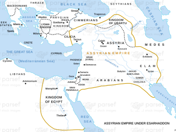
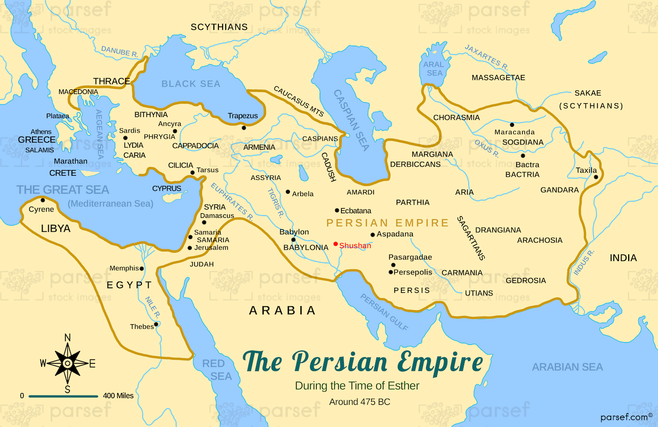
Persian Empire around 475 BC Map: This map shows the extent of the Persian Empire around 475 BCE, at its height under King Xerxes. It highlights key regions such as Persia (modern-day Iran), Mesopotamia, Egypt, and parts of India. The map provides insight into the power and reach of the Achaemenid dynasty.


Download High Resolution 300 DPI File Persian Empire around 475 BC Map


Related Maps

Israel and Judah Map image
Read More

Israel and Judah Map

Israel and Judah Map: This map shows the geographical locations of the kingdoms of Israel and Judah. It outlines the...
Read More

Assyrian Empire Map image
Read More

Assyrian Empire Map

Assyrian Empire Map: Explore the vast expanse of the Assyrian Empire at its height. This map includes major cities, trade...
Read More

The Khabur River Map image
Read More

The Khabur River Map

The Khabur River Map: This map highlights the region surrounding the Khabur River, an important river in ancient Mesopotamia. It...
Read More

Hebron Map image
Read More

Hebron Map

Hebron Map: This map focuses on the city of Hebron, a significant location in both the Old and New Testaments....
Read More