The Kingdom of the Hittites Map

The Kingdom of the Hittites Map image

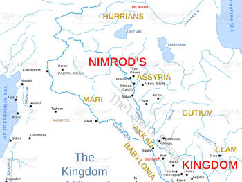
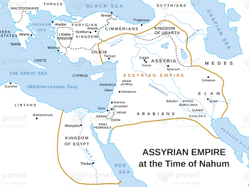
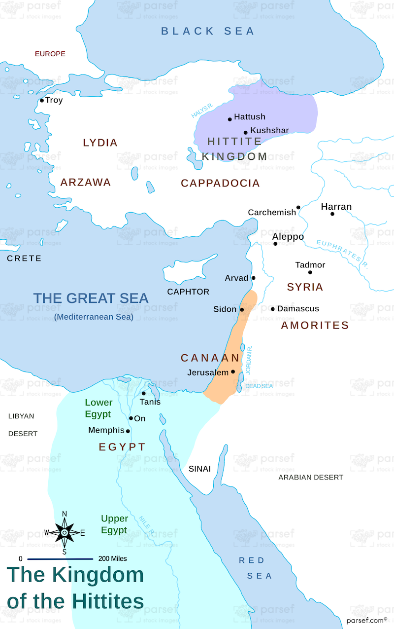
The Kingdom of the Hittites Map: This map illustrates the extent of the Hittite Empire, a powerful civilization in the ancient Near East. It covers the Hittite heartland in Anatolia (modern-day Turkey) and extends into parts of Syria and Mesopotamia. The map helps to understand the Hittites’ geopolitical influence and their interactions with neighboring cultures like Egypt and Assyria.


Download High Resolution 300 DPI File The Kingdom of the Hittites Map


Related Maps

Assyrian Empire Map image
Read More

Assyrian Empire Map

Assyrian Empire Map: Explore the vast expanse of the Assyrian Empire at its height. This map includes major cities, trade...
Read More

Exodus from Egypt Map image
Read More

Exodus from Egypt Map

Exodus from Egypt Map: This map traces the route of the Israelites during their exodus from Egypt. It highlights key...
Read More

Benjamin’s Territory Map image
Read More

Benjamin’s Territory Map

Benjamin’s Territory Map: This map outlines the tribal territory of Benjamin in ancient Israel. It highlights key cities such as...
Read More