Kingdom of the Ptolemies Map

Kingdom of the Ptolemies Map image

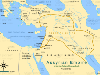
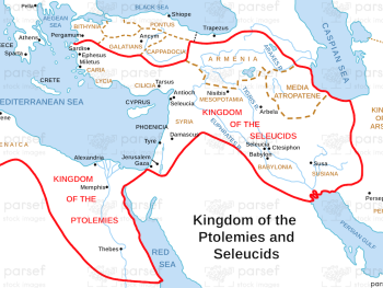
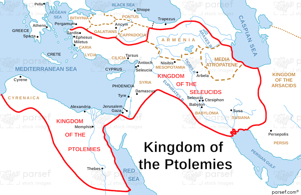
Kingdom of the Ptolemies Map: This map illustrates the territory ruled by the Ptolemies, the Hellenistic dynasty that controlled Egypt after Alexander the Great’s death. It shows key cities such as Alexandria and covers regions like Palestine. The map provides historical context for the interactions between the Ptolemaic Kingdom and the Jewish people.


Download High Resolution 300 DPI File Kingdom of the Ptolemies Map


Related Maps

Assyrian Empire Map image
Read More

Assyrian Empire Map

Assyrian Empire Map: Explore the vast expanse of the Assyrian Empire at its height. This map includes major cities, trade...
Read More

Mahanaim Map image
Read More

Mahanaim Map

Mahanaim Map: This map highlights the location of Mahanaim, an ancient city mentioned in the Bible, particularly in the stories...
Read More

Asia in Roman Times Map image
Read More

Asia in Roman Times Map

Asia in Roman Times Map: This map highlights the province of Asia during Roman rule. It includes major cities, trade...
Read More

Roman World Maccabees Map image
Read More

Roman World Maccabees Map

Roman World Maccabees Map: This map focuses on the Roman Empire’s interaction with the Maccabean Kingdom during the 2nd century...
Read More

Philistia Map image
Read More

Philistia Map

Philistia Map: This map highlights the territory of the Philistines, a group of people frequently in conflict with Israel. It...
Read More